|
An Area of Known Wolf Activity (AKWA) is designated by ODFW showing where an individual or group of wolves have been documented repeatedly over a period of time. When resident wolf activity is established, ODFW will delineate AKWA boundaries using actual location data points. In situations where wolves are resident but location data is limited, ODFW will use a fixed circle of a size based on home range data from other packs. In areas where packs have overlapped each other for a period of years, such as north of I-84 in northeast Oregon, individual pack AKWAs will be combined into multi-pack AKWAs to delineate resident wolf use areas. AKWAs will periodically change as new information becomes available. Producers with livestock in or near these areas are encouraged to implement non-lethal measures to minimize conflicts between wolves and livestock.
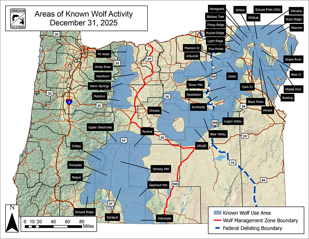
Download map (pdf)
Wolves and Wolf Packs by County
Some packs are found in more than one county; in those cases, pack information is listed in the county where the group spends the most time. The statewide map is updated annually, the county maps are updated as needed to designate new AKWAs.
Click here for information about AKWAs that are no longer active.
|

